Case study
Malleefowl mounds mapped using remote sensing technology
Mount Gibson, Western Australia
Client
Capricorn Metal Pty Ltd
Project duration
October 2021 - November 2021
Mount Gibson Gold Project is approximately 280 km northeast of Perth, Australia. This region is home to Malleefowl (Leipoa ocellata), an indigenous ground-dwelling bird listed as vulnerable. Capricorn Metals Pty Ltd (Capricorn) commissioned Fugro to provide a fauna and habitat Geo-data study to establish whether Malleefowl nest in the project area so they could develop effective protection and management plans.
Life cycle
Planning, feasibility, conceptual design
Design
Construction
Operations and maintenance
Decommissioning
Show full process

Sense.Lidar®

Sense.Lidar®
Sense.Lidar® uses cloud processes and AI to improve lidar classification for making informed decisions, improves schedules and reduces costs.
Project area
Ha
Challenge
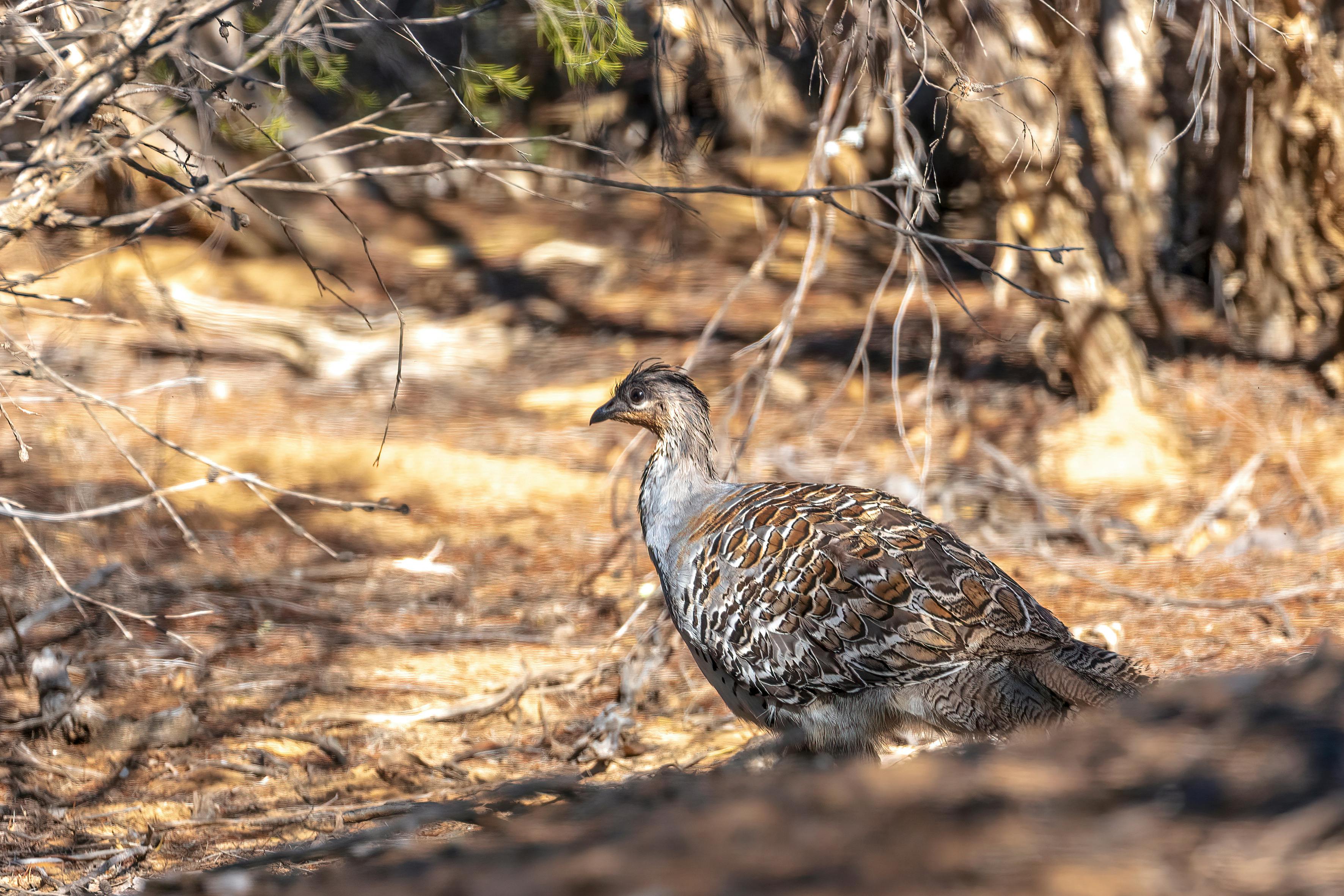
Malleefowl reproduce by building a mound on the ground that can be over 4 m in diameter and in which they incubate their eggs. Active mounds are important evidence of Malleefowl habitat but Capricorn’s 13,400 hectare project area was covered in dense vegetation, so locating and mapping the mounds on foot or using all-terrain vehicles (ATVs) would have been impractical and time-consuming, and presented significant health and safety risk to surveyors. The deadline for delivery of final data to the field teams was also tight, so our client needed fast and accurate data acquisition.
Solution
We devised an efficient and hi-tech remote solution, acquiring and analysing airborne lidar point cloud and imagery data, and deploying our lidar and camera systems on a fixed wing, twin engine aircraft. This allowed the entire project area to be safely and efficiently covered in one flight.
The lidar data was sampled at >20 points per square metre (PPSM) with concurrent RGB imagery at a resolution of 5 cm.
We also created a digital elevation model (DEM) derived from a high-density lidar point cloud to enable greater spatial resolution and accuracy, which Capricorn would use to assist with development planning, hydrology and construction.
By combining the acquired high-quality data with quantitative and qualitative analysis, including machine-learning, we mapped the locations of Malleefowl mounds for subsequent on-the-ground inspection within the client's tight timeframes. Our accurate data solution also enabled us to rank the mounds according to likelihood of current usage by detailing their definition: better defined mounds were likely in use, whereas ill-defined mounds were likely abandoned.
Our remote solution eliminated the need for extensive ground access, thus allowing the study to progress in the same field season.

FIGURE A -Mallee Fowl, Ranking well defined

FIGURE B- Mallee Fowl, Ranking possible

FIGURE C- Mallee Fowl Ranking possible, looks abandoned
Innovative highlight
State-of-the-art Geo-data acquisition combined with machine-learning allowed us to identify Malleefowl mounds while delivering significant time- and cost-savings, minimising onsite health and safety risk, and satisfactorily resolving Capricorn’s environmental challenges.
Impact
Our efficient and safe acquisition, analysis, and delivery of data for the large project area reduced the number of environmental scientists required for ground-truthing.
The airborne survey required no land access, reducing the environmental impact of the study and making it safer for everyone involved.
Lidar sensors can map under the tree canopy, so our survey detected Malleefowl mounds that would have been missed by traditional airborne imagery alone. This increased our identification of the mounds for maximum accuracy.
Finally, the high-resolution lidar data also provided accurate topography of the area, delivering insights into the terrain type and variation. When combined with other environmental inputs, it enabled Capricorn to generate hydrology models for flood modelling, environmental impact assessments, and future construction projects across the site.
“The Malleefowl mapping and high-resolution imagery helped us to plan our environmental surveys and will greatly assist in habitat mapping. The imagery and DEM data also allowed us to easily minimise environmental disturbance when planning regional drill exploration and future infrastructure. This survey was a valuable and essential part of the Mount Gibson Gold Project feasibility study.”
Alex Thomas
Senior Project Coordinator, Capricorn

What we do at Fugro