A fi wi wata: Why mapping Jamaica’s ocean space is a national imperative
Published
24 Sep 2026
Author
Dr. Valrie Grant, Caribbean Lead, Climate and Nature
Jamaica's exclusive economic zone (EEZ) is more than twenty times its land area, yet much of that ocean space remains poorly understood. Momentum is building around a national effort to map, manage and safeguard it, captured in a phrase from the stakeholder workshops: "A fi wi wata," patois for "our water." This article explains why success depends less on technology than on governance, alignment and a shared vision for the future.
Think of Jamaica as a big ocean state
The map of Jamaica that most of us carry in our minds ends at the shoreline. That picture is misleading. Jamaica's maritime space is more than twenty times the size of its land territory, which means the country should not be understood as a small land mass surrounded by water but as a big ocean state with significant rights, responsibilities and opportunities.
Those opportunities span fisheries and food security, renewable energy, maritime transport, tourism, biodiversity conservation, subsea infrastructure, maritime security, disaster resilience and areas of the blue economy that have not yet been fully explored. However, there is a catch: you cannot responsibly manage what you do not sufficiently understand.
That is why mapping the EEZ creates something more valuable than a dataset. It creates the information base from which Jamaica can decide what to protect, what to develop, where to invest and where greater knowledge is still required.
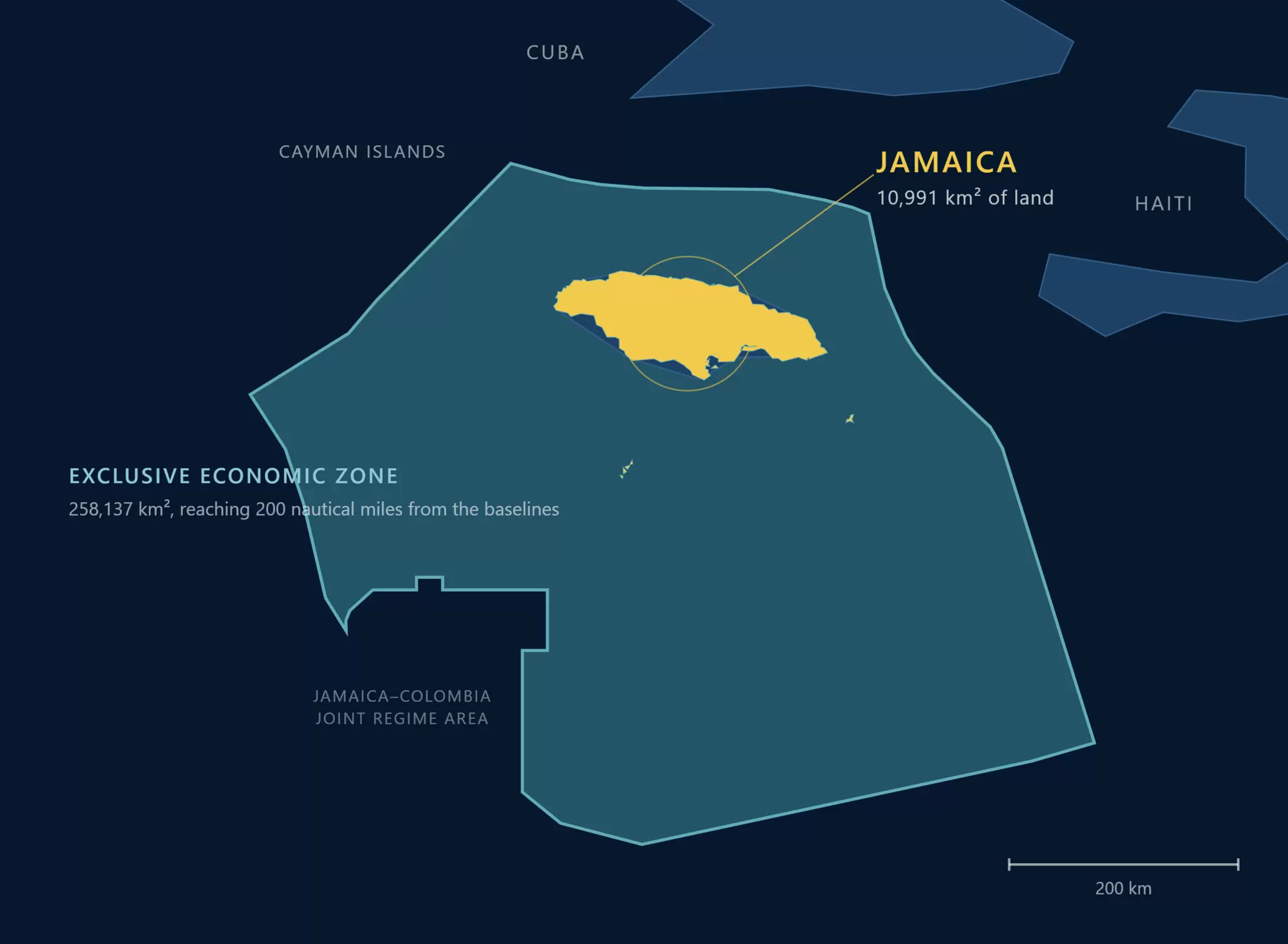
Jamaica's exclusive economic zone covers more than twenty times its land area, giving the country significant ocean rights, responsibilities and opportunities
The real challenge is not more data
It would be easy to frame Jamaica's task as a data collection problem. It is not. Countries can spend significant sums collecting excellent data and still fail to change decisions. The harder questions come first. What information already exists? Who holds it? Can it be accessed? Is it interoperable? Where are the critical gaps? Which national decisions require better information most urgently? And who is responsible for maintaining the information after it is collected?
In our work on ocean programmes around the world, we at Fugro have seen that the most successful efforts begin with exactly these questions: governance and stakeholder alignment first, technology selection later. That is why governance should precede, or at least develop alongside, large-scale acquisition. Jamaica needs a clear national framework defining priorities, institutional responsibilities, data standards, sharing arrangements, security considerations, custodianship, financing and updating.
The objective is not to map the ocean for the sake of producing a map. It is to create an enduring national ocean-intelligence capability.
Alignment before acquisition: what the workshops revealed
The stakeholder workshops held in April and May brought together government, academia and industry, and their most encouraging outcome was the breadth of participation. Those groups do not approach the ocean from the same perspective, and that was precisely the value of the conversation: fisheries managers ask one set of questions, environmental agencies another, hydrographers another, security agencies another and researchers another still.
The workshops demonstrated that knowledge, capacity and data already exist within Jamaica; the opportunity is to connect those pieces around a shared national ambition. One lesson from working across the Caribbean is that collaboration happens at the speed of trust. A national EEZ programme cannot belong to a single institution; it must become an ecosystem of contributors and users.
So perhaps the workshop's most important output was not a technical specification. It was the beginning of alignment.
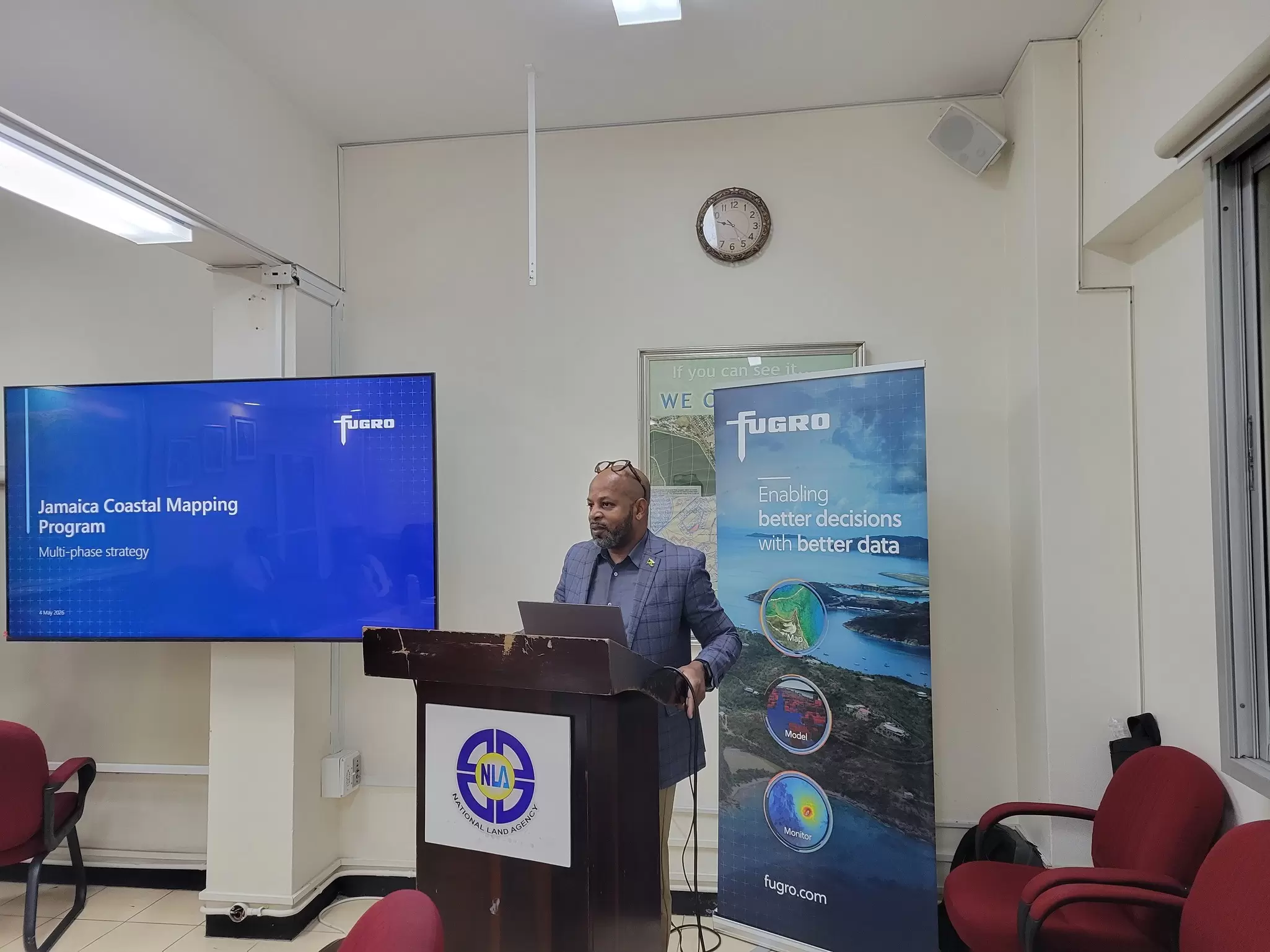
Wayneworth Hamilton, Director, Surveys & Mapping, NLA, welcomes the group to the NLA and opens the workshop
Why this is Jamaica's moment
Several forces are converging. Climate risk is increasing. Coastal and marine ecosystems are under pressure. Maritime security and food security are becoming more important. Jamaica is pursuing blue-economy opportunities and has committed to protecting 30% of its EEZ by 2030. Hurricane Melissa's impacts and ongoing recovery have further underscored the urgency of reliable coastal and marine data to guide resilient reconstruction, reduce future disaster risks and protect vulnerable communities.
At the same time, advances in satellite observation, hydrography, remote sensing, autonomous systems, cloud computing and artificial intelligence are changing what is technically and economically possible. The need is real: even in 2026, only 28.7% of the world's ocean floor has been mapped, according to the Seabed 2030 project. Importantly, Jamaica is not starting from zero. The National Land Agency (NLA) has been building national hydrographic capability, including internationally trained hydrographers.
Better marine information then flows into very practical decisions: where coastal communities are most exposed to flooding and storm surge, where marine protected areas should be established or expanded, where subsea cables and offshore energy infrastructure can safely be located, and where information gaps create unnecessary risk for public or private investment. EEZ mapping is not an end product. It becomes part of the evidence infrastructure for hundreds of future decisions.
A fi wi wata
During the May workshop, a phrase emerged that captured the spirit of the effort: "A fi wi wata," patois for "our water." It resonated because it made something technically complex very simple and very Jamaican: this is our responsibility; let us understand it.
There is also something powerful about turning an enormous, largely unseen space into something people can visualise. Once Jamaicans can see and understand their ocean space differently, they can begin to value it differently. The phrase conveys a whole programme in a few words: our ocean, let's understand it, let's map it, and then let's use that knowledge wisely.
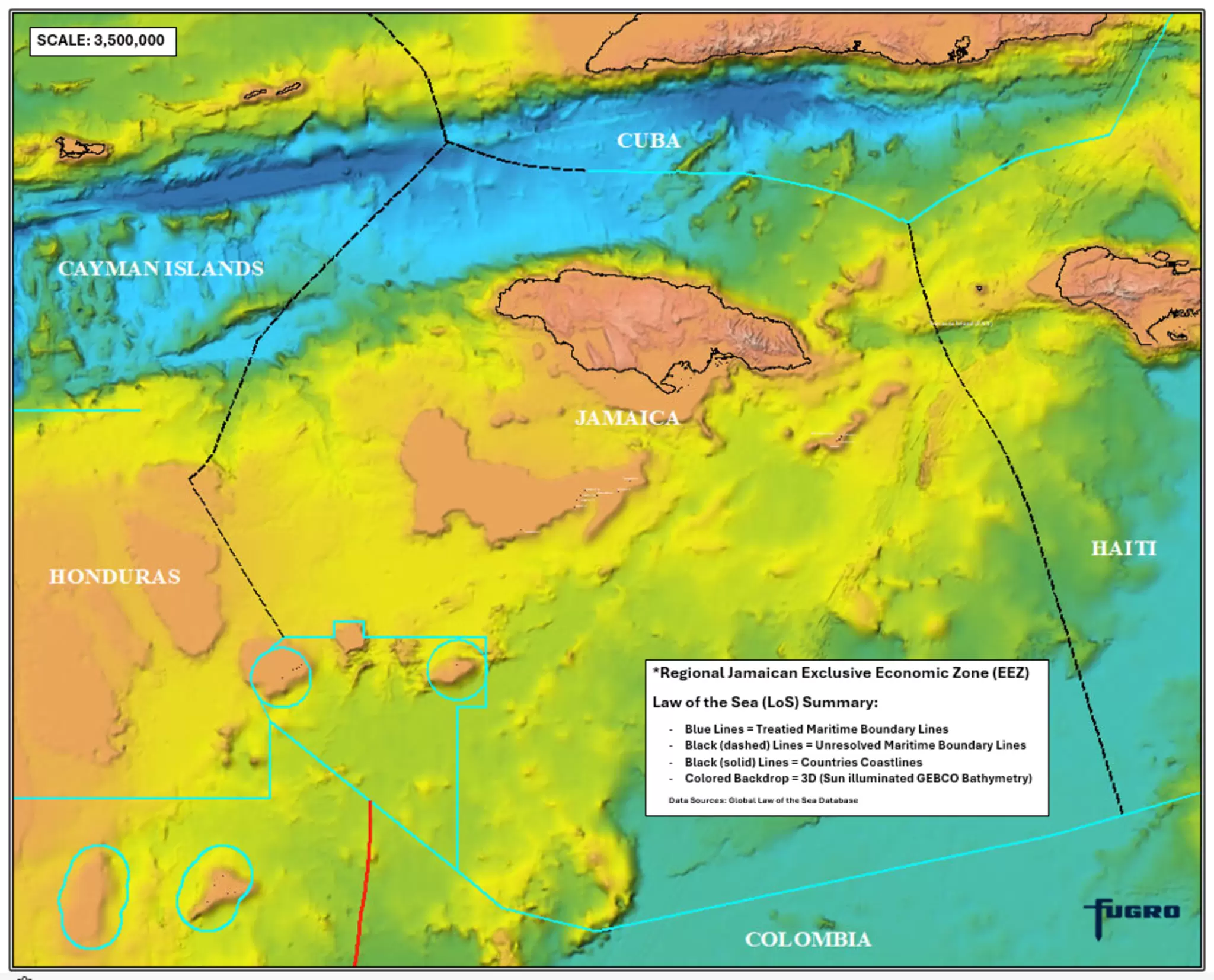
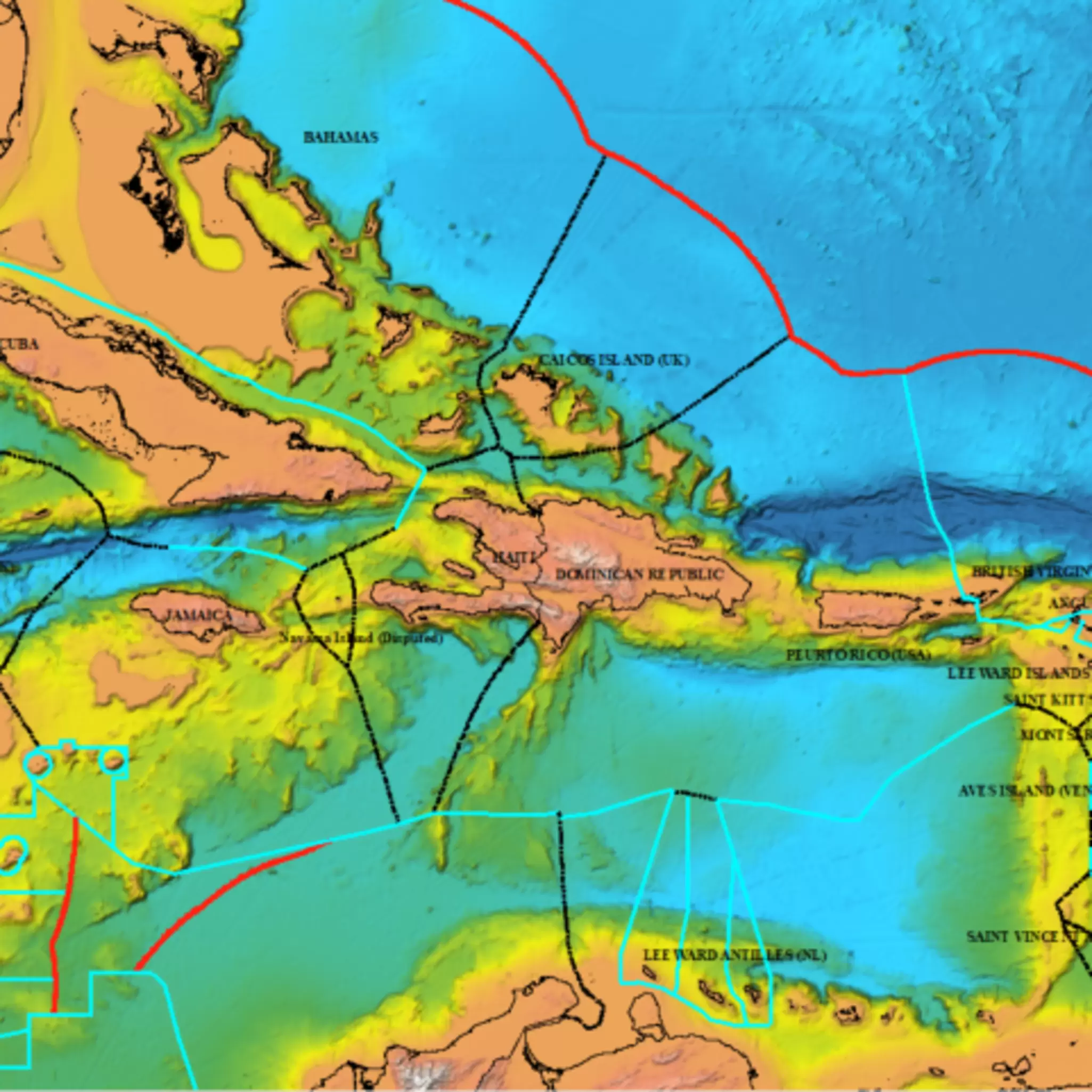
Jamaica's exclusive economic zone extends far beyond the island itself, bounded by settled maritime boundaries (blue) and boundaries still to be resolved (dashed black) over sun-illuminated GEBCO bathymetry
Two leadership stories converge
Jamaica has a remarkable relationship with global ocean governance. The United Nations Convention on the Law of the Sea (UNCLOS) was opened for signature in Montego Bay in 1982, the International Seabed Authority is headquartered in Kingston, and in 2029 Montego Bay will host the first Our Ocean Conference to be held in the Caribbean. This is part of the story from Montego Bay 1982 to Montego Bay 2029.
The country is also earning recognition for geospatial leadership: the 2026 Esri President's Award recognised Jamaica's use of geographic information systems (GIS) for data-driven decision-making and its integrated national geospatial infrastructure. EEZ mapping sits at the intersection of those two stories, and it supports something I have said consistently about small island developing states (SIDS): we may be small in land area, but we are big ocean states with global significance.
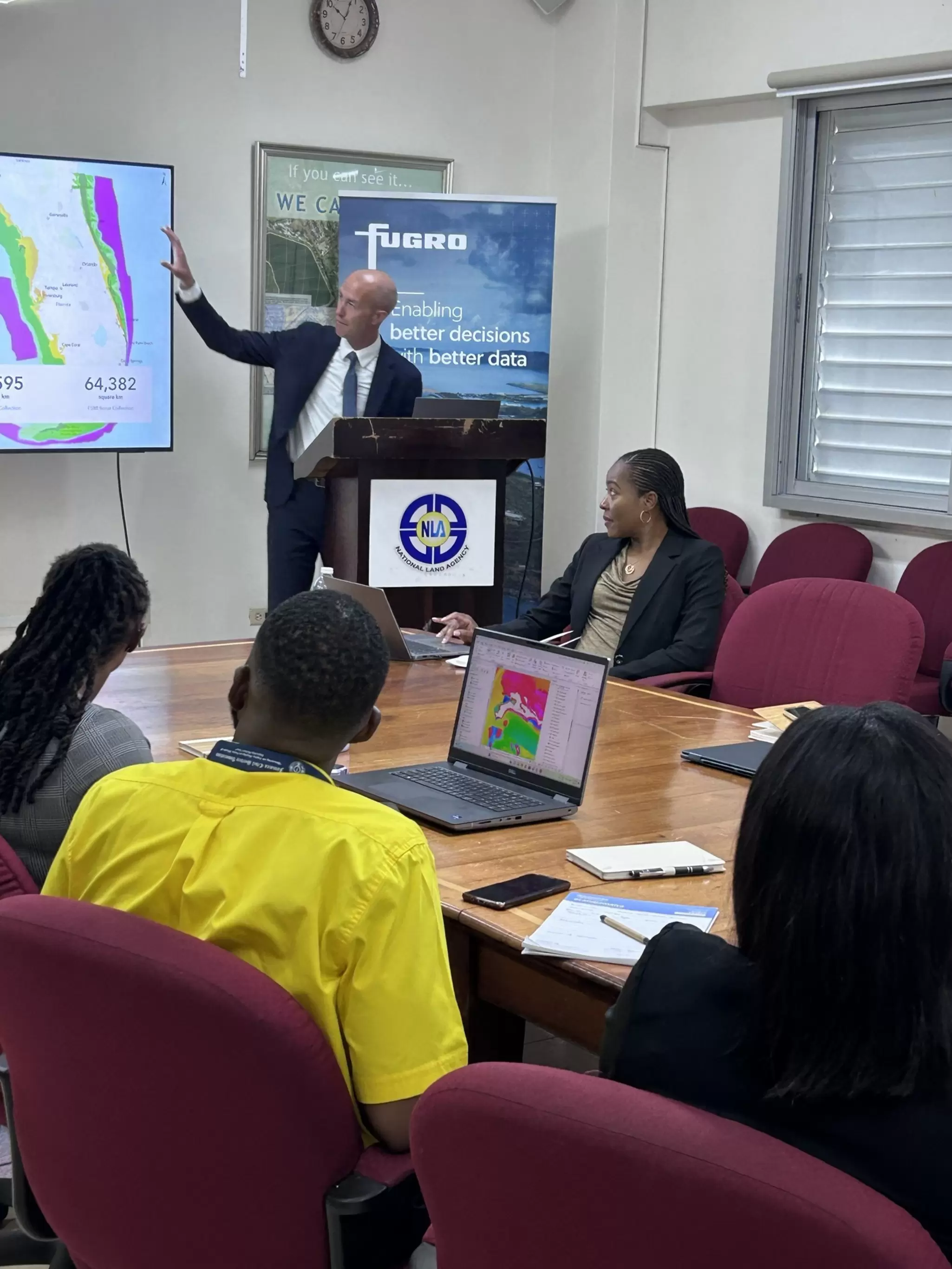
Greg Murphy, Fugro's Climate and Nature Market Leader, presents seabed mapping data during the May stakeholder workshop at the NLA
Locally led, globally supported
Jamaica's approach offers a template for other SIDS: begin with the decisions you need to make rather than the technology; inventory existing information and capabilities before commissioning new acquisition; establish governance early; prioritise, because not every square kilometre requires the same data, resolution or urgency; and build local capability. For SIDS, especially, the right model is locally led and globally supported. International partners can bring technology, finance, expertise and global experience, but capability and institutional knowledge must increasingly reside within the country.
The strongest technical partner for this effort will not begin with a catalogue of sensors and ask what the country wants to buy. The better approach is to begin with Jamaica's objectives and work backwards: which decisions need support, where the priority gaps are, what should be mapped first, at what accuracy, at what cost, in what phases, and how capability is transferred and sustained locally. Fugro can contribute global experience in ocean mapping, marine geospatial programmes and capacity development, but the priorities, governance and sustained capability must remain Jamaica-led. Following the May scoping workshop with the key stakeholders, the immediate priority is to consolidate what was heard, agree on the next-phase scope and define the pathway from stakeholder ambition to an actionable national roadmap.
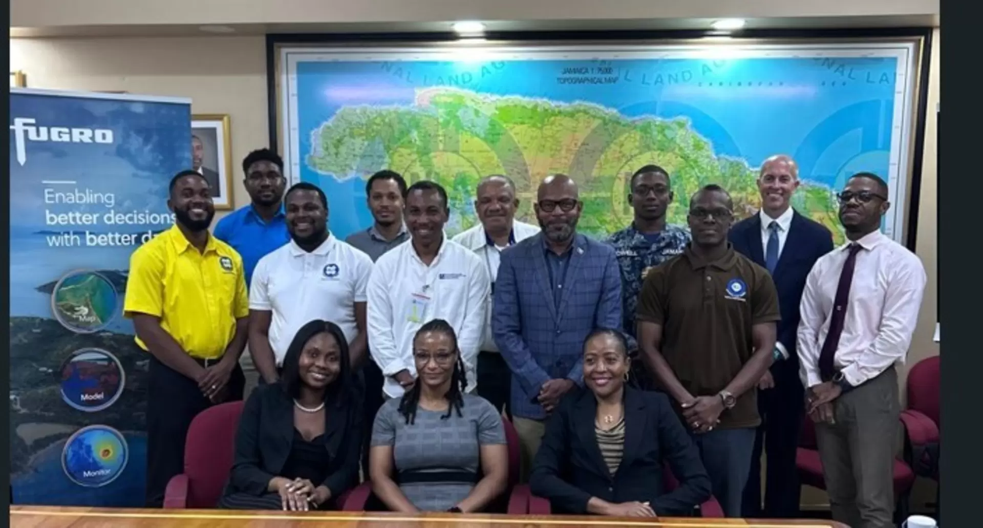
Stakeholders from government, academia and industry gathered in May to begin aligning around a shared national ambition for Jamaica's ocean space
What success looks like in 2029
By 2029, success should not be measured by whether every square kilometre of Jamaica's EEZ has been mapped at the highest possible resolution. It should mean that Jamaica knows what information it has, understands its critical gaps, and has a funded, prioritised plan for closing them.
It would also mean priority areas have been mapped, datasets held across institutions can work together, Jamaica has strong local hydrographic and marine-geospatial capability, information is being updated appropriately rather than treated as a one-off project, and the data is demonstrably informing decisions about resilience, conservation, fisheries, infrastructure, security and investment.
When the world arrives in Montego Bay for the 2029 Our Ocean Conference, Jamaica should be able to say more than “A fi wi wata.” It should be able to say: we understand it, we are investing in it, and we are engaged stewards for generations to come. Jamaica is not defined by the limits of its shoreline. We are a big ocean nation with vast opportunity, global significance and a responsibility we embrace with pride.
Expertise
Law of the Sea and Maritime Boundaries
The Law of the Sea, governed by the UNCLOS treaty, defines maritime limits and rights. It is essential for managing ocean resources, protecting the rights of sovereigns and ocean users, and resolving maritime disputes.